A Great Place to Visit, A Better Place to Live...all About Cochise County
Sierra Vista, Arizona is a proud Army military town of about 45,000 people. Sierra Vista is the commercial center for Cochise County and parts of northern Mexico. We are a small city with big city conveniences. You will find affordable homes with outstanding mountain views here .
On this page you will find information about Sierra Vista and Cochise County. It is comprehensive, informative, factual, and decidedly practical. I invite you to take a look around and stay awhile.
Sierra Vista Arizona
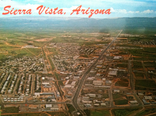
Discover the magic of the high desert that is Sierra Vista Arizona. Sierra Vista Arizona is situated in the heart of the picturesque Sonoran desert of Arizona. This is America's frontier. This is the area where the famous Indians Cochise and Geronimo once roamed. Sierra Vista means 'not sand', but grass, mesquite trees, rocks, mountain lions, javalina, rattlesnakes, scorpions, and the tarantulas that inhabit the area, although you could spend years here and never see them. We are located in the southeast corner or Arizona, about 70 miles south east of Tucson. Mexico is about 20 miles due south. To cross the border you will go about 60 miles to Nogales or Agua Prieta. Naco is another small crossing about 30 miles away.
The Sierra Vista Arizona is the youngest of the major communities of Cochise County, but its history is rooted in the early settlement of Arizona by its connection with Fort Huachuca. Sierra Vista has grown from a satellite community dependent on the fort to one which has a vigorous life of its own. Constantly expanding modern shopping and recreational opportunities attract birders and nature lovers from all over the country and by far the best place in the country to live, raise a family and retire.
Several mountain ranges surround the Sierra Vista Arizona and at an elevation of 4,623 feet, the city boasts a view of the Mule, Dragoon, Whetstone and Huachuca Mountains. As the population nears 42,000, (over 55,000 when you include the un-incorporated area) Sierra Vista is one of the fastest growing communities in Arizona and is the business and cultural center of Cochise County. The city annexed Fort Huachuca into its boundaries in 1971. The two communities hold a strong working relationship and share many facilities and joint activities.
But its our weather that brings in the newcomers. The Sierra Vista Arizona area summers are much cooler than the Phoenix area which is famous for baking at a crisp 105 to 110 degrees from June through September. We are a desert so rain is rare; most comes during the Monsoon season mid July to September. We average less than seven inches a year and most days are sunny and cloud-free. Sierra Vista Arizona is known for its temperate climate and claims the best in the country. Temperatures range from average of 90's with very low humidity in summer to 50's in winter, with temps going down 30 to 40 degrees at night. We do get a few days over 100 and we may also get a couple of days with snow.
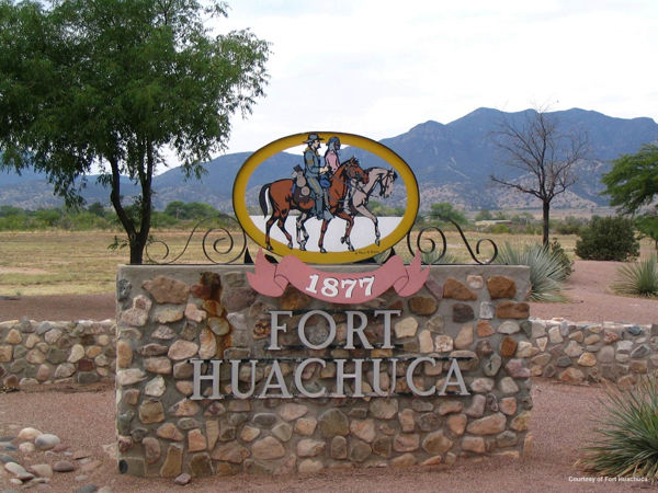
The main gate of Fort Huachuca is at the west end of Fry Boulevard, Sierra Vista Arizona. Most of the commercial buildings are located on Fry Boulevard and south on Highway 92. The city has built, in the last few years, a new City Hall, Police Station, Library, High School, several more lighted softball and baseball fields, and our award winning Aquatic Center provides hours of fun for the family in the wave pool and tube slide. Our local 18-hole golf course lies in the shadows of the majestic mountains. Our night skies are an astral delight with bright stars seen from horizon to horizon, and for a closer look, our observatories will accommodate you. We have the 'Mall of Sierra Vista', featuring anchors of Dillards, Sears and Best Buy. Most of the well known chain fast-food restaurants are here (interesting note that McDonalds had their first drive-thru in the country here) along with Chilis, Applebees, Outback Steak House and over 60 other restaurants. We have the traditional box stores such as Wal-Mart, K-Mart, Home Depot, and Lowes as well as many smaller stores like Staples, Checker Auto Parts and Walgreens Drug. Ft Huachuca/Sierra Vista Arizona Airport is an alternate landing site for the Space Shuttle. Sierra Vista is a haven for 'Snowbirds', mostly from the north of the country and Canada. Many choose to retire and live here. It is also known as a retirement community with many military retirees living here. Our area is well known as a birders paradise to include Ramsey Canyon with 14 of 15 species of Hummingbirds.
Sierra Vista is a fun place with lots going on around the year, like the Winter Arts Festival and Art Discovery Series which present plays, concerts, musicals, dances, recitals and readings. Western Heritage week offers the Annual Cochise Cowboy Poetry and Music Gathering, Arizona Folklore Preserve Workshops, stage performances, artist jam sessions and free poetry and music. And don't miss the Arizona Junior Rodeo, the Mule Mountain Marathon and the Huachuca Stampede Rodeo, the 4th of July Celebration, the Miss Sierra Vista Pageant, the Art in the Park Arts and Crafts Sale, the Festival of Color Balloon Rally, Festival of the Southwest, the Family Festival and the largest Christmas Parade in Arizona. As for bird watchers, golfers, hikers, and nature lovers of all kinds, Sierra Vista is surrounded by natural wonders (including Ramsey Canyon).
History of Sierra Vista, Arizona
Sierra Vista (Spanish for "Mountain View") has always enjoyed clean air, ideal weather and spectacular views of the Mule, Dragoon, Whetstone and Huachuca Mountains. With a population of over 42,000 people, Sierra Vista is one of the fastest growing communities in Arizona and is the business center of Cochise County. But it wasn't always so. About 1915, a small collection of rock-walled, tin-roofed buildings with a general store, saloon and gas station comprised the community known as Buena. Sometime later the name was changed to Overton and still later to Garden Canyon. In 1927, a post office was established under the name of Fry, in honor of a local pioneer family whose decedents still live in this area. It wasn't until 1956 that Sierra Vista was incorporated. There is little doubt that Sierra Vista would not even exist were it not for the Army post of Fort Huachuca (pronounced (waa-CHOO-ca).
Today, Sierra Vista is experiencing rapid growth and offers a dash of the Old West blended with a modern city against the backdrop of beautiful scenery.
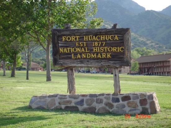
Sierra Vista is also home to Fort Huachuca, a national historic landmark and a modern army post headquartering the U.S. Army Intelligence Center and School, Army Communications Command and Army Electronic Proving Ground. Built in 1877, Ft. Huachuca's original Victorian-style officer's quarters are still in use.
In March 1877, Captain Samuel M. Whiteside and two companies of the 6th United States Cavalry established a camp at the mouth of Huachuca Canyon. This isolated camp had two missions: protect settlers in the area and stop Apache raiding parties from escaping into Mexico.
In 1882, the camp became a permanent station and was designated a "Fort." Soldiers constructed buildings of wood, stone and adobe. By 1886, Fort Huachuca became the advance headquarters for General Nelson A. Miles' campaign against Geronimo. Following Geronimo's surrender in August 1886, the threat of Apache depredations in the area subsided, and many of the frontier posts were closed. Yet, Fort Huachuca remained active because of its strategic location near the Mexican border and its low incidence of sickness. In the decades that followed, troops at Fort Huachuca were used in operations against other renegade Indians, Mexican bandits and American outlaws.
The all black 24th Infantry was the first entire regiment stationed at the Fort. The all black 10th Cavalry "Buffalo Soldiers" arrived in 1913, served in Pershing's punitive expedition against Pancho Villa in 1916, and helped guard the U.S.-Mexican border until 1931. (Pershing had been a junior officer with the 10th in the Philippines. His respect for these dedicated, if segregated, soldiers earned him the name "Black Jack.")
During World War II, the post population swelled to over 30,000 as two black Infantry Divisions, the 92nd and 93rd, trained here. With the departure of these units to the war zone, little activity remained, and at the end of the war the Post was declared surplus.
Shortly after the onset of the Korean War, Fort Huachuca was designated a training site for Engineer troops in the construction of military airfields. Libby Army Airfield resulted. At the end of the Korean War the Post once again fell into limbo.
In 1954, the Chief Signal Officer, United States Army, discovered southeastern Arizona ideal in area and climate for the testing of electronic and communications equipment. As a result, the U.S. Army Electronic Proving Ground (EPG) reopened Fort Huachuca as an active Army Post. From that time on, the Post has steadily increased in importance as a vital contributor to the national defense.
Fort Huachuca was annexed by the City of Sierra Vista in 1972, and these two entities currently enjoy one of the most cordial relationships in the United States.
Tombstone Arizona
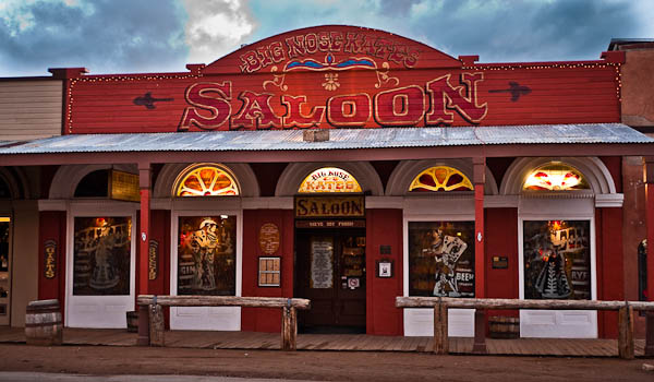
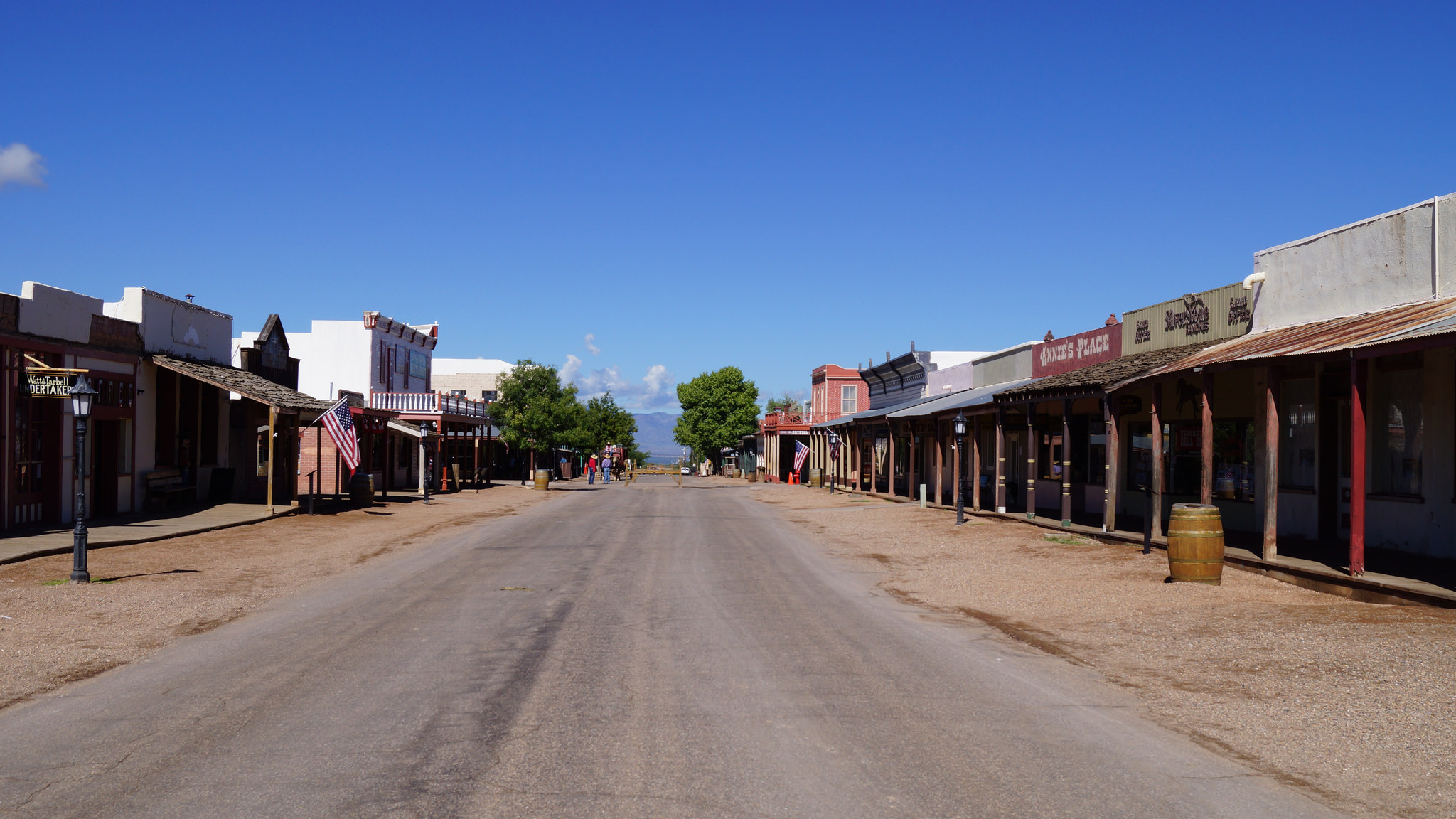
The Famous 'Town to Tough to Die', Tombstone, is about 16 miles, with Bisbee about 30 miles away. The Town too Tough to Die," Tombstone was perhaps the most renowned of Arizona's old mining camps. Many of Tombstone's historic buildings are within an area bounded by Fremont, 6th, Toughnut and 3rd streets. Among them are St. Paul's Episcopal Church, built in 1882; the Rose Tree Museum & Bookstore, home of the world's largest rose tree; and, the Tombstone Epitaph building, where the oldest continuously published paper in Arizona is still being printed. Western printing history exhibits in the front office are free to the public. Truly a Historical American Landmark, Tombstone is America's best example of our 1880 western heritage, which is well preserved with original 1880's buildings and artifacts featured in numerous museums.
- Good Enough Mine Tours
- Stage Coach & Trolley Rides
- Ghost Hunting Tours
- Bird Cage Theatre
- Tombstone Courthouse State Historic Park
- Boothill
- Jeep Tours
- Old Time Photos
- Great Places to Eat... Longhorn Restaurant and Café Margarita
- Great Places to Shop, like The Shady Lady's Closet
Bisbee Arizona
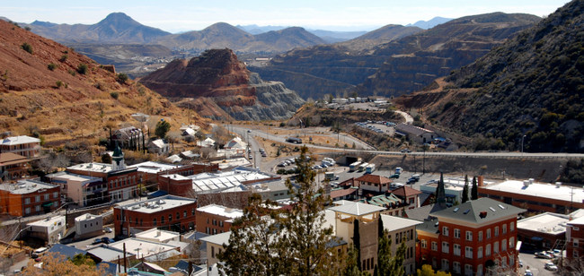
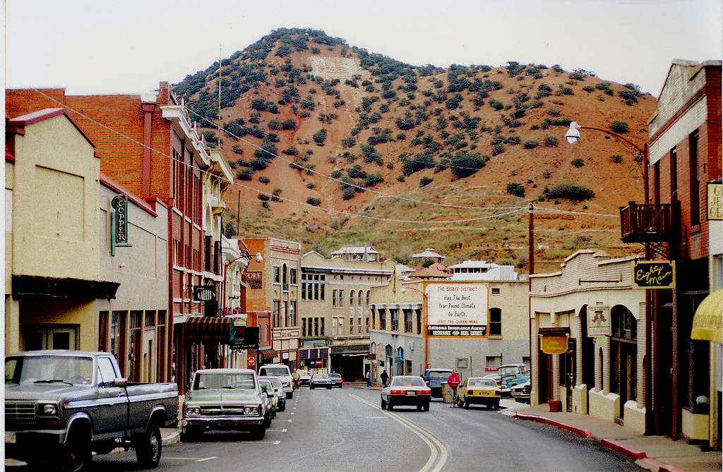
Once one of the Wests most prosperous copper mining towns, Bisbee is now a modern artists colony perched on picturesque hillsides. Bisbee grew from humble beginnings as a mining camp to a booming town in the 1880s after the discovery of one of the richest mineral sites in the world. In its heyday, Bisbee was the largest and rowdiest city between St. Louis and San Francisco. In 1908, a fire ravaged most of the commercial district along Main Street, leaving nothing but a pile of ashes, but by 1910 it was rebuilt in the image of its original Victorian charm. The old saloons, office buildings and other landmarks still stand and most of the town is a registered National Historic District.
Bisbee is the major transportation link for the twin plant manufacturing operations in Naco and Cananea, Sonora, Mexico. Bisbee's economy over the years has evolved from mining into a diversified base of tourism, government, and light manufacturing. Phelps Dodge Corporation still maintains a strong mining presence in the town. The historic downtown district supports the local economy through art galleries, curio shops, cafes and other retail trade.
Youll want to visit the Lavender Open Pit Mine, historic Brewery Gulch and the many fascinating galleries and shops. About 30 miles south of Sierra Vista at an altitude of over 5000 feet, Old Bisbee, a National Historic Landmark, offers a unique sense of living history. See the open pit mine to experience the history of copper. Learn the special geology of the area at the museum. Visit the many specialty shops featuring arts, crafts and culinary delights. Bisbee is the seat of Cochise County government and an Arizona Main Street City.
